The TEM product range
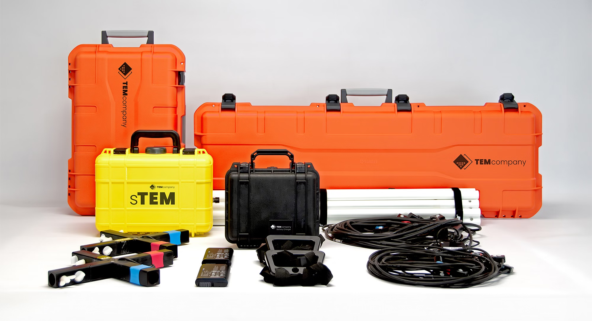
sTEM
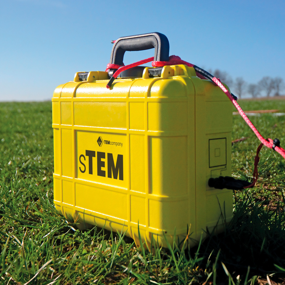
Light and portable
sTEM5, sTEM10, sTEM20The adaptable sTEM and sTEM profiler deliver accurate, reliable, efficient, and affordable geophysical surveys.
Conducting single-site measurements, capturing data that reaches depths up to 200 m (656 ft). Our most affordable entry level sTEM geoscanner is operated via an Android or iOS app.
| Built for – Adaptable system for groundwater mapping, MAR, and sand and gravel deposits. | |
| Depth of investigation – Up to 600 m (2000 ft). | |
| Dual moment – 1 Amp and 5 /10 /20 Amp. | |
| Portable: Shipping boxes for easy travel. | |
| Connectivity – Wi-fi, iOS & Android app. | |
| Weight – Systems from 15 to 40 kg (33 – 88 lbs). | |
| Price – Starting from 22.000 EUR |
tTEM
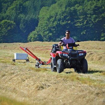
Towed system
tTEM, SnowTEM, FloaTEMThe tTEM, SnowTEM, and FloaTEM deliver large-scale area coverage for land and water-based geophysical mapping.
Towed by an ATV, quad bike, or dinghy, the tTEM family of geoscanners deliver high-resolution subsurface images for mapping groundwater, MAR, and sand and gravel deposits.
| Built for – Large area groundwater mapping, MAR, and sand and gravel deposits. | |
| Depth of investigation – Up to 180 m (600 ft). | |
| Dual moment – 3 Amp and up to 30 Amp. | |
| Drive speed: Up to 20 km/h (12 miles/h). | |
| Connectivity – Wi-fi, iOS & Android app. | |
| Weight – Systems start from 129 kg (284 lbs). | |
| Price – Starting from 80.000 EUR |
xTEM
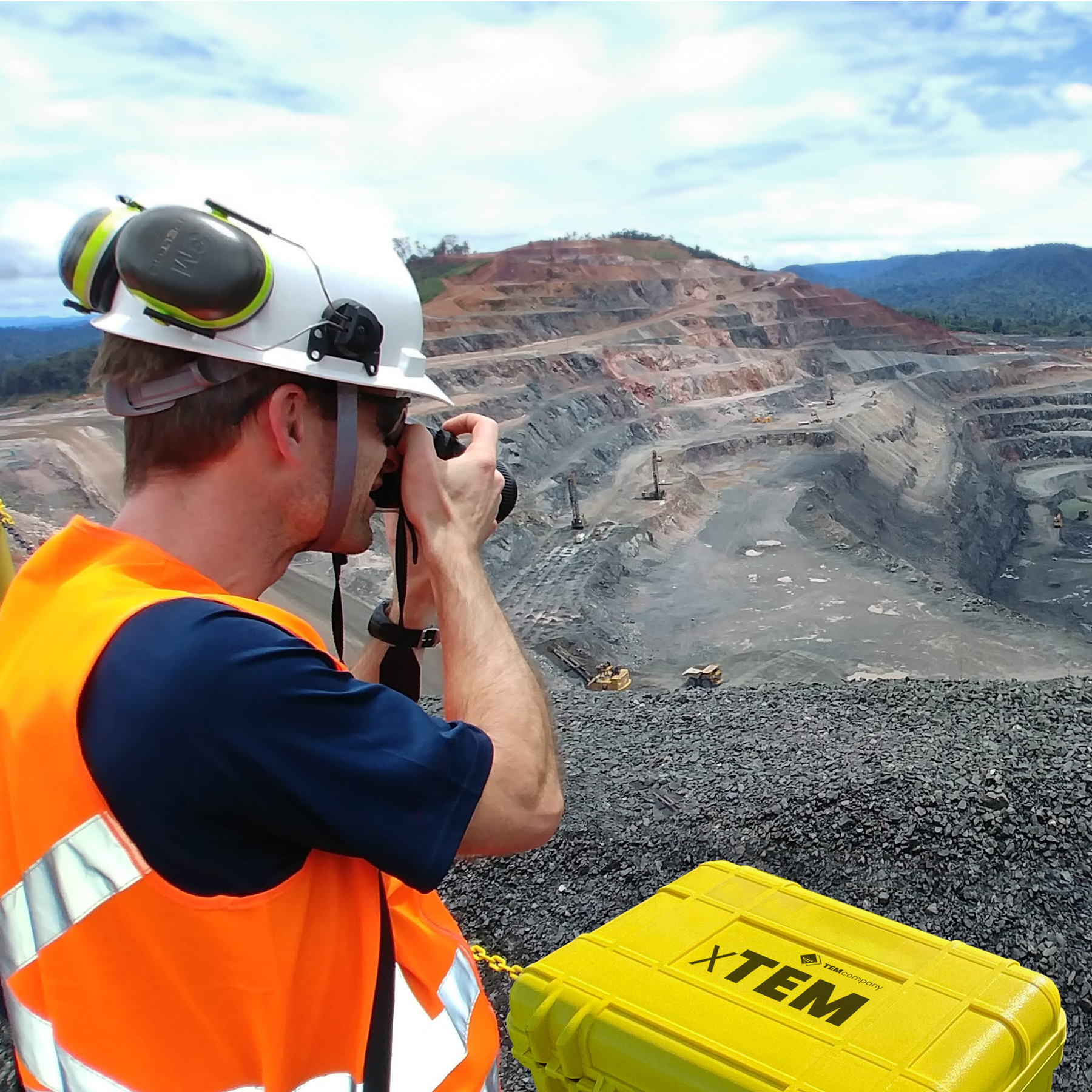
Mining and minerals
xTEMWith a compact setup, the xTEM enables discreet and non-invasive deep-penetration geophysical surveys.
Accurate and robust, the xTEM operates via an Android or iOS app. The transmitter capacity enables detailed measurements enabling 3-D imaging ideal for mining and mineral exploration.
| Built for – Deep penetration, natural resource, mineral and mining target mapping. | |
| Depth of investigation – Up to 600 m (2000 ft). | |
| Dual moment low – high current – 1 Amp to 30 Amp. | |
| Portable: Shipping boxes for easy travel. | |
| Connectivity – Wi-fi, iOS & Android app. | |
| Weight – Systems start from 20 kg (44 lbs). | |
| Price – Contact us for prices |
TEM2Go
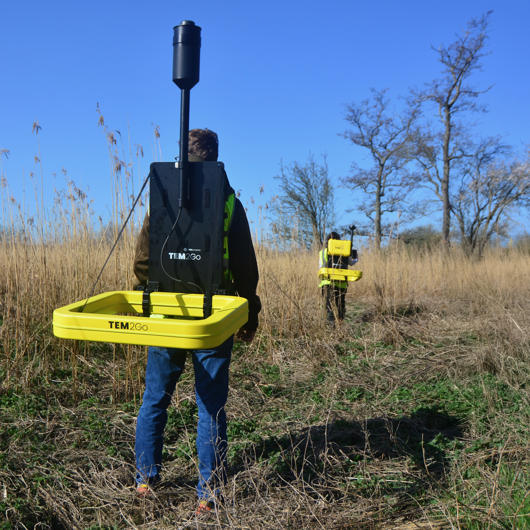
New for 2025
Mobile TEM ExplorationTEM2GO delivers ultimate flexibility over the most challenging terrains: If you can walk it, the TEM2Go can gather the data.
Built for ultimate portability and flexibility on site, the TEM2Go delivers survey data for construction sites, groundwater mapping, and managed aquifer recharge.
| Built for – Construction, groundwater mapping, MAR, and sand and gravel deposits. | |
| Depth of investigation – Surface to 75 m (246 ft). | |
| Dual moment low – high current – 1 Amp to 10 Amp. | |
| Portable: Shipping boxes for easy travel. | |
| Connectivity – Wi-fi, iOS & Android app. | |
| Weight – Systems start from 35 kg (77 lbs). | |
| Price – Starting from 45.000 EUR |
Built to travel, engineered to explore
TEM geoscanners and mobile apps enable survey teams to work faster and more accurately, delivering high-resolution data to significant depths.
Our TEM technology
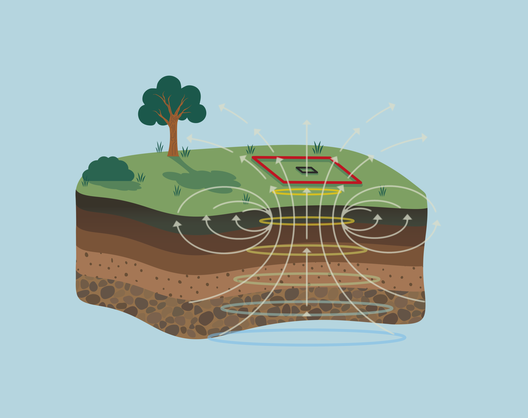
The Transient Electromagnetic (TEM) geophysical survey method is a modern technique designed to measure vertical resistivity profiles with particular sensitivity to conductive materials.
- Particularly sensitive to conductive materials
- Non-invasive method using wire loops to transmit and receive signals
- Leaves no trace on the survey site after data collection
- Highly efficient, requiring a transmitter loop and one or two smaller receiver coils
- Can achieve depth measurements of up to 600 meters
- Entire process takes only a few minutes, from setup to resistivity modeling
Where to use TEM
TEM surveys are highly versatile and are particularly effective in the following areas. Our instruments deliver accurate, fast data to solve many geophysical challenges.
Groundwater Exploration: Identifies freshwater reserves, saline water, and contamination zones to optimize well placement and drilling depth.
Mineral Detection: Locates mineral deposits based on their unique resistivity signatures.
Geological Mapping: Reveals the subsurface structure for various geological studies.
Environmental Surveys: Assesses contaminants and salination in the soil.
The benefits of TEM
Transient Electromagnetic (TEM) mapping is a non-invasive method that ensures that survey areas remain undisturbed, as it uses wire loops to transmit and receive electromagnetic signals without leaving physical marks on the terrain.
TEMcompany geoscanners enable fast, accurate geophysical data collection alongside easy instrument setup, delivering significant time savings for consultants, contractors, and clients.