Passive ambient noise imaging for mineral exploration
Solutions and Services for Mineral Exploration
Golden Taurus Ingeniería (GTI), in collaboration with the Institute of Mine Seismology (IMS), offers to the mining sector solutions and services for mining exploration, using the advanced technology known as Ambient Noise Tomography (ANT)
Ambient Noise Tomography (ANT) is a passive seismic technique. This method employs a strategically deployed array of geophones on the ground surface. These geophones provide analog signals of ambient seismic noise, which are subsequently digitized and recorded. This process allows for the detection of coherent seismic energy between pairs of sensors, in particular, surface waves. Through the subsequent processing of this recorded data, geophysicists can determine the subsurface velocity structure. In summary: Ambient Noise Tomography utilizes passive seismic data to generate 2D/3D subsurface velocity models.
How to generate 2D/3D subsurface velocity models
• PROCEDURE UTILIZING ANT
The following steps outline how we will acquire the necessary subsurface data to generate 2D/3D velocity models. This will culminate in a technical report that presents our methodology, a detailed discussion of the results, and an interpretation of our findings.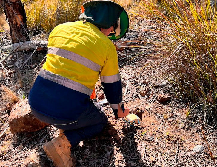
1 - Node deployment
For imaging projects, dense arrays of temporary nodes are required. These are typically buried in a shallow hole (10 - 15 cm) and covered with a few centimetres of soil to obscure from view and protect from wind noise.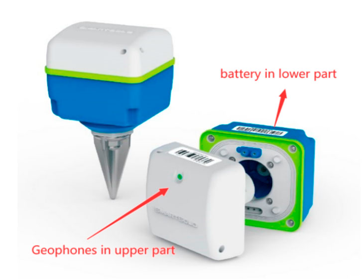
2- SmartSolo node
IMS makes use of Smartsolo 5 Hz nodes for imaging projects, completely independent self-contained temporary sensors with onboard battery, flash memory and GPS for accurate timing and location detection.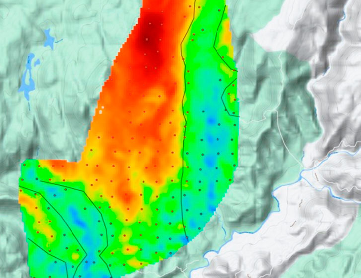
3- 2D Velocity imaging exploration
Ambient Noise Tomography involves a two-step inversion: in the first step velocity measurements between pairs of sensors are regionalized into 2D velocity maps for a range of surface wave frequencies. These maps often clearly outline different geological units or fault boundaries.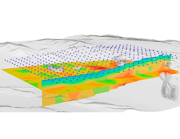
4- 3D Velocity imaging exploration
The final inversion step in ANT, inverts the dispersion (velocity as a function of frequency) to fit a matching velocity-depth profile. This is done for every coordinate in the survey area and assembling the results of every inversion results in a 3D subsurface velocity model.• ADVANTAGES:
- Does not require active sources- Low cost and low environmental impact
- Reduces development costs by informing targeted drilling campaigns
• WHEN AND WHY USE ANT :
- Ambient noise tomography imaging should be applied in early-stage exploration to identify structural controls and inform subsequent drilling campaigns.- A high resolution array with shorter node-spacing should also be deployed in late-stage exploration for low cost resource estimation/ orebody delineation.
• SCOPE OF WORK
Rental (or permanent) Deployment:
- Array design
- Rental seismic nodes for deployment at the designated locations
- (Optional) installation and retrieval of nodes
Data Acquisition and Processing:
- Download the recorded seismic data from the deployed nodes
- Perform data quality control procedures
Seismic Inversion and Imaging:
- Calculate cross-correlations
- Surface wave velocity picking
- Conduct ambient noise surface wave tomography inversion
- Generate a digital 3D seismic velocity volume
Reporting:
- Prepare a comprehensive report outlining the methodology used, a detailed discussion of the results, and interpretation of the findings.
Budget:
- Node rental of 2 – 3 weeks, processing costs 4 – 8 weeks including report