The tTEM family
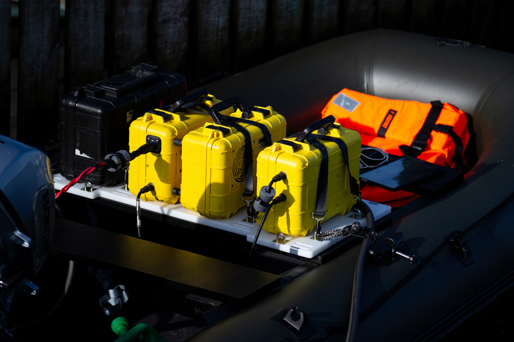
tTEM
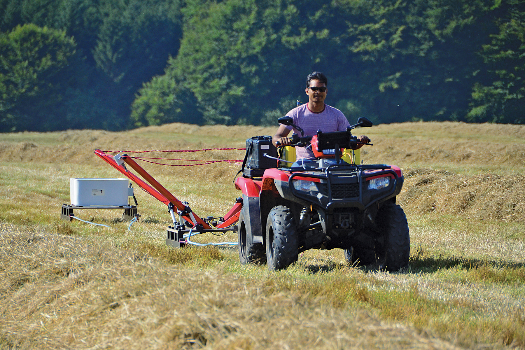
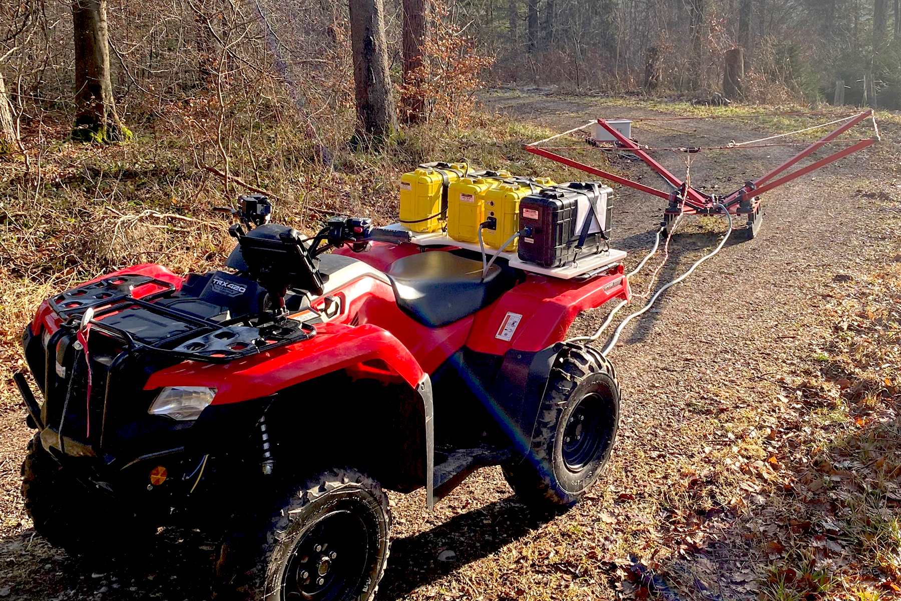
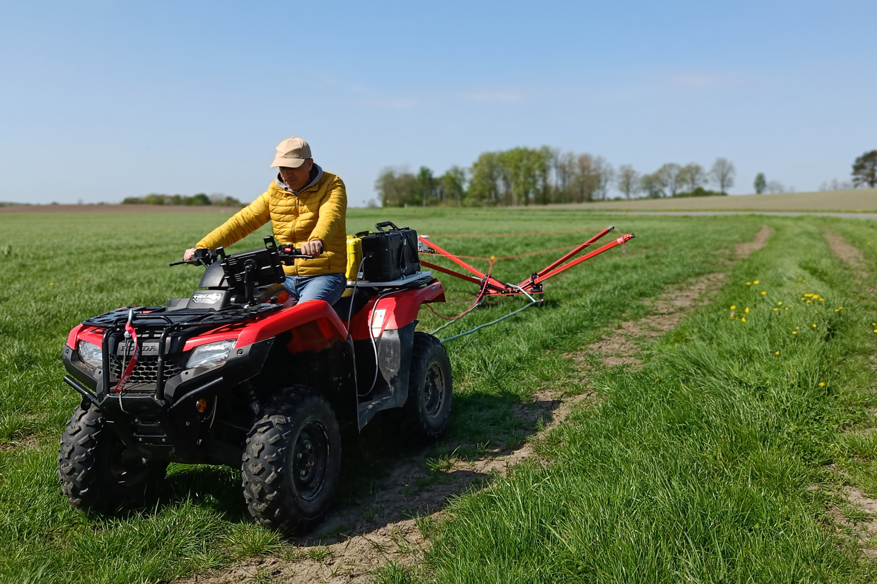
ATV towed land based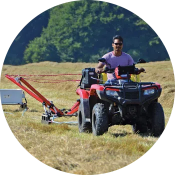
The ATV towed tTEM delivers accurate and reliable data for use cases, including mapping groundwater, MAR, sand, and gravel deposits.
Conducting continuous measurements, capturing data reaching depths of 180 m (590 ft). The tTEM geoscanner is operated via an Android or iOS app.
Configuration options
| 221 Transmitter coil – 2 x 2 m, 1 turn – Maximum depth of investigation 130 m. Less depth of investigation as 331 but slightly better resolution in shallow subsurface. 2 x 2 m coil enables access to narrower driving tracks. | |
| 331 Transmitter coil – 3 x 3 m, 1 turn – Depth of investigation 130 m. This system is optimized for a large depth of investigation and high resolution of shallow layers. | |
| 333 Transmitter coil – 3 x 3 m, 3 turns – Depth of investigation 180 m. System provides a large transmitter moment but with slightly less resolution in the shallow subsurface compared to the 331. | |
| 443 Transmitter coil – Configuration not available | |
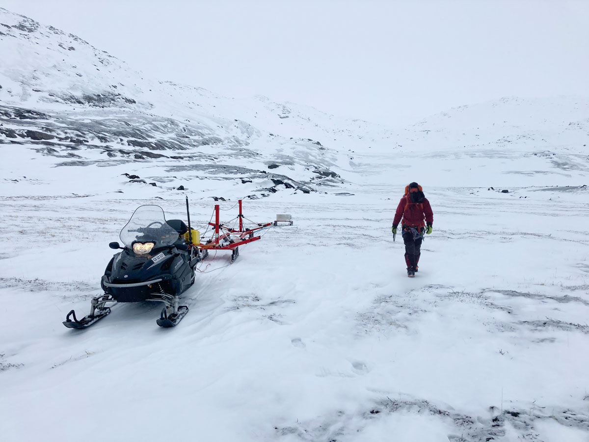
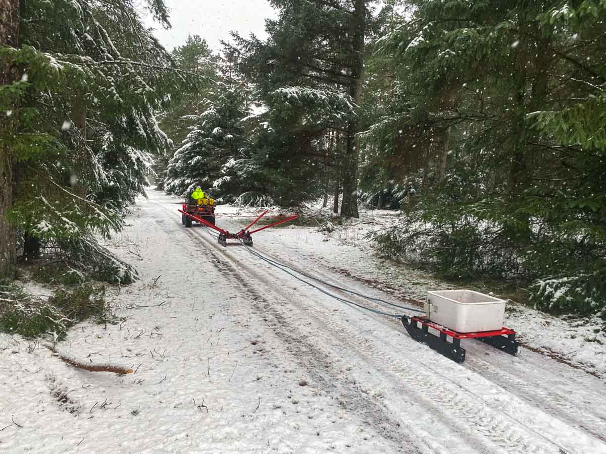
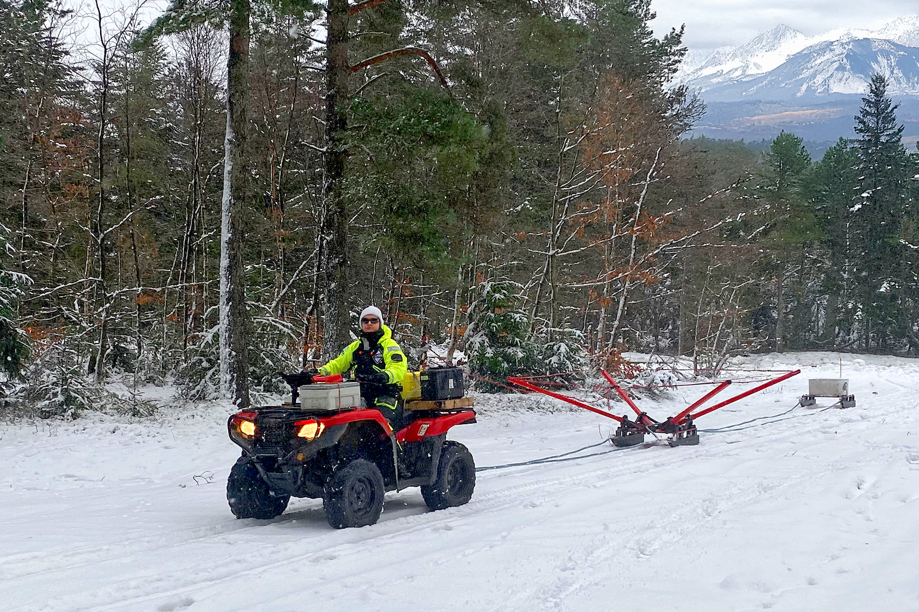
SnowTEM
Cold weather surveys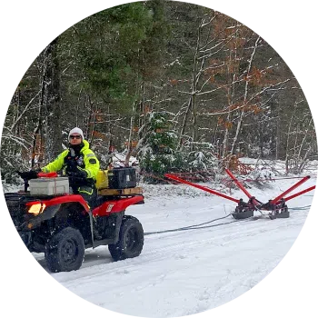
The SnowTEM delivers detailed mapping data in snow and ice. Suitable for permafrost, groundwater, sand, and gravel deposit mapping.
Conducting continuous measurements, capturing data reaching depths of 180 m (590 ft). The SnowTEM geoscanner is operated via an Android or iOS app.
Configuration options
| 221 Transmitter coil – 2 x 2 m, 1 turn – Maximum depth of investigation 130 m. Less depth of investigation as 331 but slightly better resolution in shallow subsurface. 2 x 2 m coil enables access to narrower driving tracks. | |
| 331 Transmitter coil – 3 x 3 m, 1 turn – Depth of investigation 130 m. This system is optimized for a large depth of investigation and high resolution of shallow layers. | |
| 333 Transmitter coil – 3 x 3 m, 3 turns – Depth of investigation 180 m. System provides a large transmitter moment but with slightly less resolution in the shallow subsurface compared to the 331. | |
| 443 Transmitter coil – Configuration not available | |
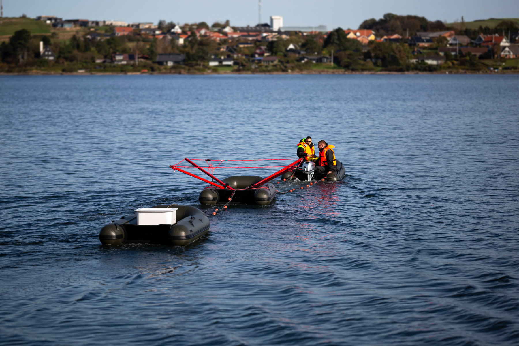
FloaTEM
Underwater surveys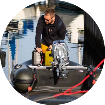
FloaTEM is the tTEM solution that delivers accurate and reliable data for mapping aquifers and investigating water bodies.
FloaTEM is an hydrogeophysical scanner for river and shallow sea bottom imaging. It enables aquatic geophysical surveys that deliver detailed imaging data.
Configuration options
| 221 Transmitter coil – 2 x 2 m, 1 turn – Maximum depth of investigation 130 m. Less depth of investigation as 331 but slightly better resolution in shallow subsurface. 2 x 2 m coil enables access to narrower driving tracks. | |
| 331 Transmitter coil – 3 x 3 m, 1 turn – Depth of investigation 130 m. This system is optimized for a large depth of investigation and high resolution of shallow layers. | |
| 333 Transmitter coil – 3 x 3 m, 3 turns – Depth of investigation 180 m. System provides a large transmitter moment but with slightly less resolution in the shallow subsurface compared to the 331. | |
| 443 Transmitter coil – 4 x 4 m, 3 turns – Depth of investigation - Variable. Maximum transmitter moment designed for FloaTEM operation on freshwater/saltwater/brackish water. | |
Get to know the tTEM
The tTEM modular system comes in different configurations, enabling you to create an instrument that delivers the data you need for your specific project environment. Find out more about the various setups, discover the technical details, and learn how we support you and your instrument in delivering the best data for your projects.
tTEM familiy portfolio