TEM Technology
What is TEM?
TEM works a bit like sending a pulse or “ping” into the ground and then listening to how the earth responds. Different underground materials react in various ways. For example, wet clay or polluted zones allow the signal to move more easily, while dry rock blocks it and causes the signal to fade quickly. By studying these responses, TEM builds a picture of what’s hidden in the subsurface.
Benefits of TEM technology
Understand what makes TEM effective in the field
Non-invasive & efficient investigation
Carry out subsurface mapping without drilling or ground disturbance. Cover extensive areas in days, not weeks, while reducing project costs and environmental impact.
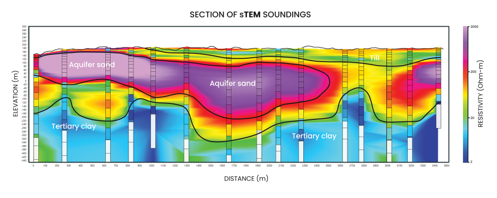
Comprehensive depth range & resolution
TEM instruments can explore the subsurface from about 100 meters to over 600 meters deep in a single survey. TEM can also detect thin layers and changes across an area that single point measurements might overlook. This gives a more complete, 3D picture of what lies beneath the surface.
Risk reduction & investment protection
Avoid costly surprises and protect capital investments. Mapping subsurface conditions before construction or drilling can prevent expensive project delays and budget overruns.
Real time data & decision making
Get immediate results in the field with instant data processing. Make informed decisions during surveys and provide preliminary results to stakeholders without office delays.
How TEM works: The Physics made simple
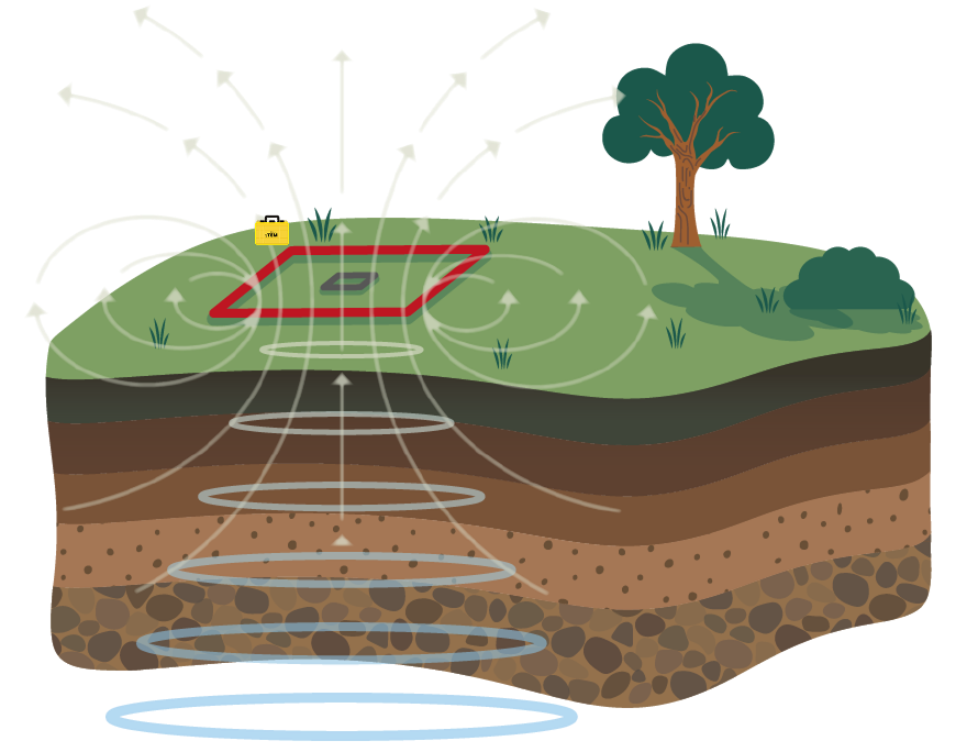
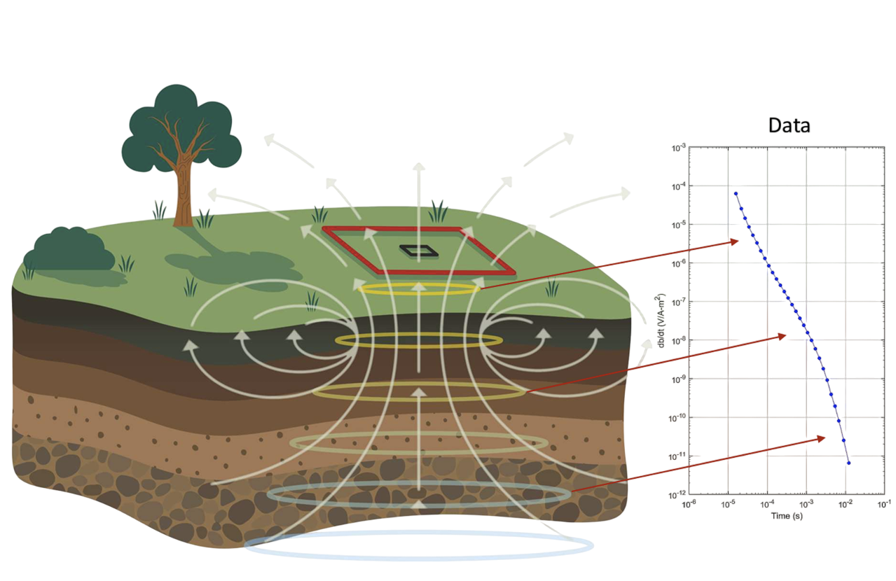
Understanding TEM is like imagining what happens when you drop a stone in water and watch the ripples spread outward. When we abruptly shut off a strong electrical current in a wire loop, we create electromagnetic “ripples” that spread through the ground like smoke rings.
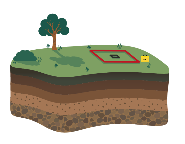
Step 1
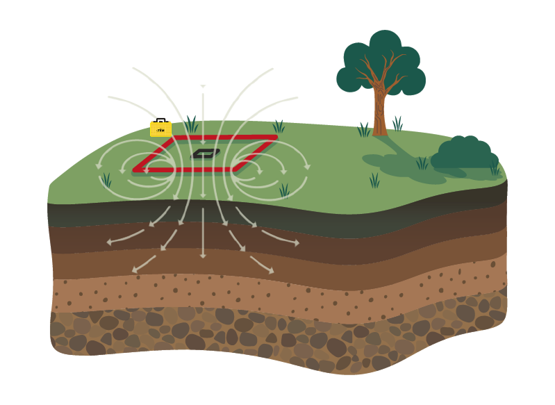
Step 2
Step 3
Step 4
Step 5