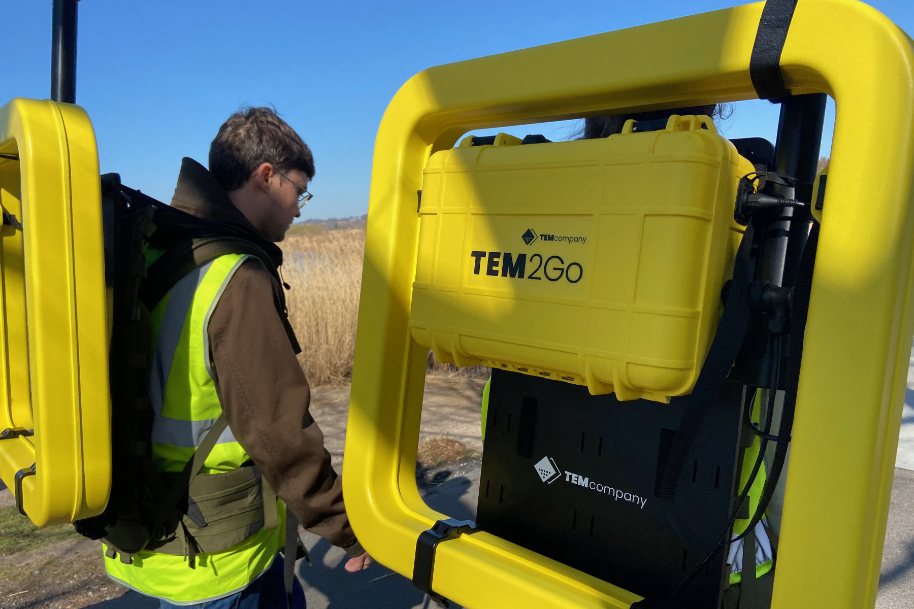
The TEM2Go
TEM2Go
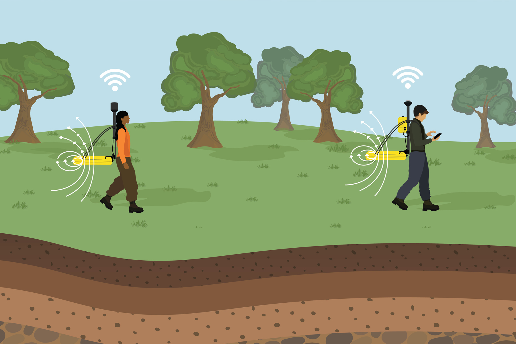
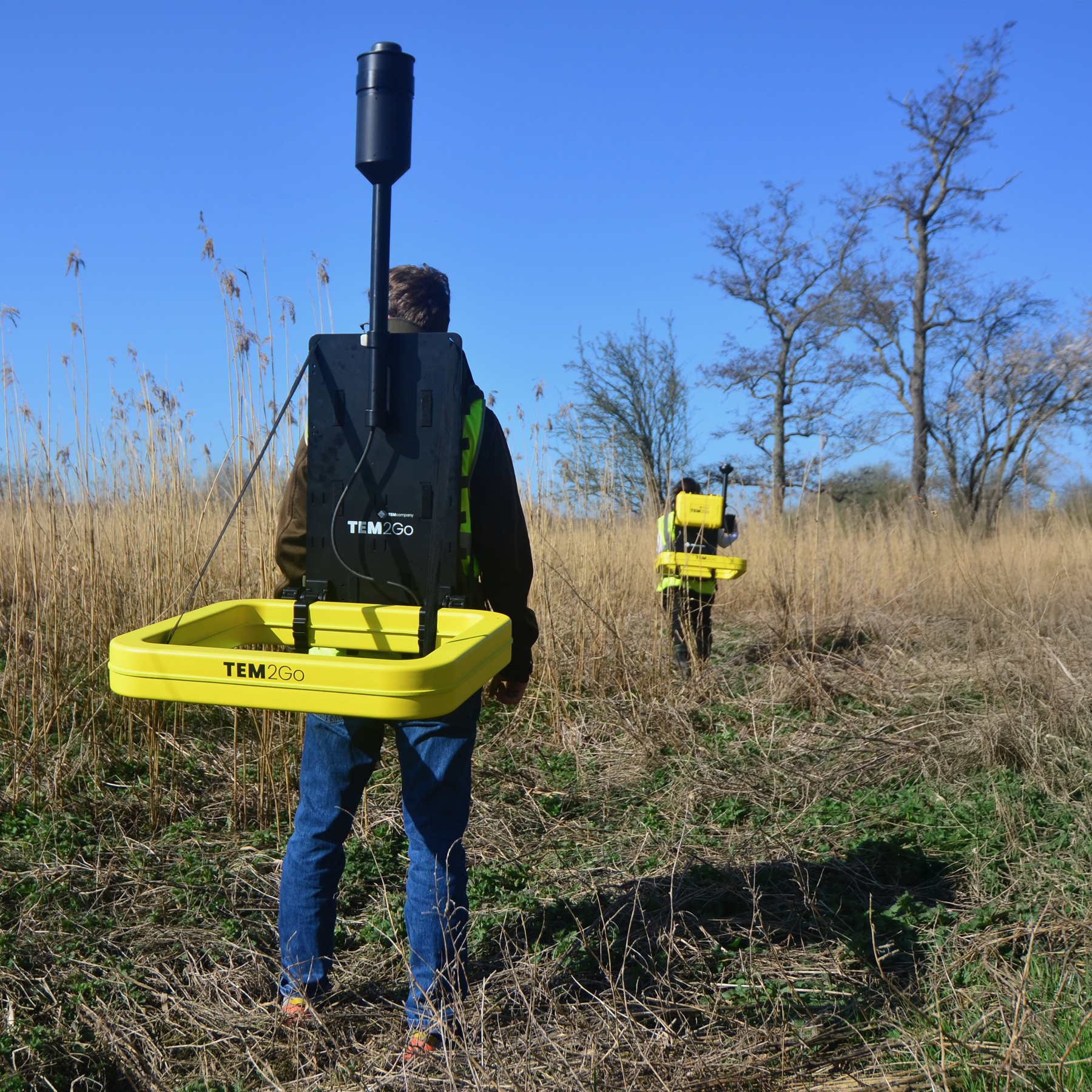
Mobile TEM explorationThe TEM2Go delivers accurate data from the surface to depths of 75 m depending on geology.
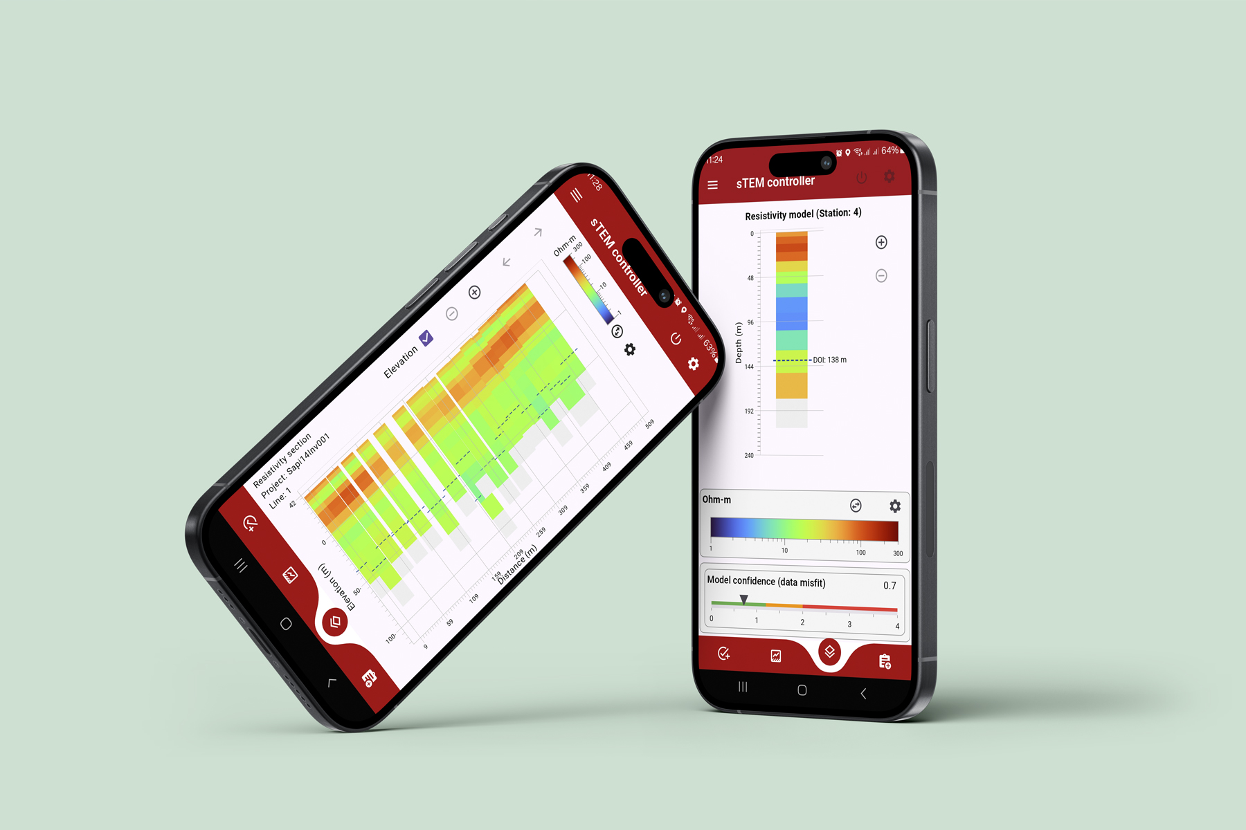
Operated via an Android or iOS App, the TEM2Go's wirelessly connected transmitter and receiver are separated by a distance of 15 – 20 m (50 - 65 ft). Data is measured continuously while walking, capturing the conductivity structure of the subsurface from the top surface to depths of 75 m dependent on the resistivity of the geological layers. The TEM2Go has real-time processed data, inverted models, and a map display.
Configuration options
| Transmitter coil sizes 65 x 65 cm (2 ft x 2 ft) | |
| Transmitter output current – 1 Amp (turn-off time ~ 3 us) and 10 Amp (turn-off time ~ 6 us) | |
| Transmitter weights – 15 kg (33 lbs) | |
| Receiver coil sizes – 65 x 65 cm (2 ft x 2 ft) | |
| Receiver weight - 10 kg (22 lb) | |
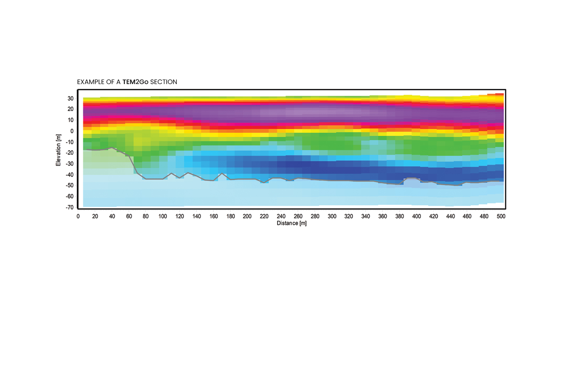
| Depth of investigation – From the surface to 75 m (246 ft), depending on geology | |
| Independent wireless receivers – GPS position of transmitter and receiver plus independent distance measurement | |
| Connectivity – WiFi, iOS & Android | |
Get to know the TEM2Go
Next-generation geoscanner for construction, groundwater mapping, managed aquifer recharge, and mining.
The TEM2Go is built to deliver high-quality transient electromagnetic data suitable for effectively and quickly mapping survey areas, monitoring tailing dams, mapping clay and sand on the road transect, depth to bedrock, discovering suitable drill locations, and minimizing the chance of an unexpected underground barriers when planning construction sites.
The TEM2Go is built to deliver high-quality transient electromagnetic data suitable for effectively and quickly mapping survey areas, monitoring tailing dams, mapping clay and sand on the road transect, depth to bedrock, discovering suitable drill locations, and minimizing the chance of an unexpected underground barriers when planning construction sites.