Fractured Bedrock Boreholes in Togo
Siting boreholes in Togo - Fractured bedrock
A well-siting campaign was carried out in Togo in 2022 using tTEM which resulted in recommendations of multiple borehole sites. The survey was conducted by HydroGeophysics Group, Aarhus University together with local partners, with the purpose of resolving the geology and finding potential sites for drilling water giving boreholes. The tTEM results located a several fracture zones which resulted in very successful boreholes.
Project Background
n March 2022, a well siting campaign using tTEM was carried out in Kpetchihoe, Togo. The mapping project was conducted by the Hydro Geophysics Group, Aarhus University, Denmark, in collaboration with Plan International.
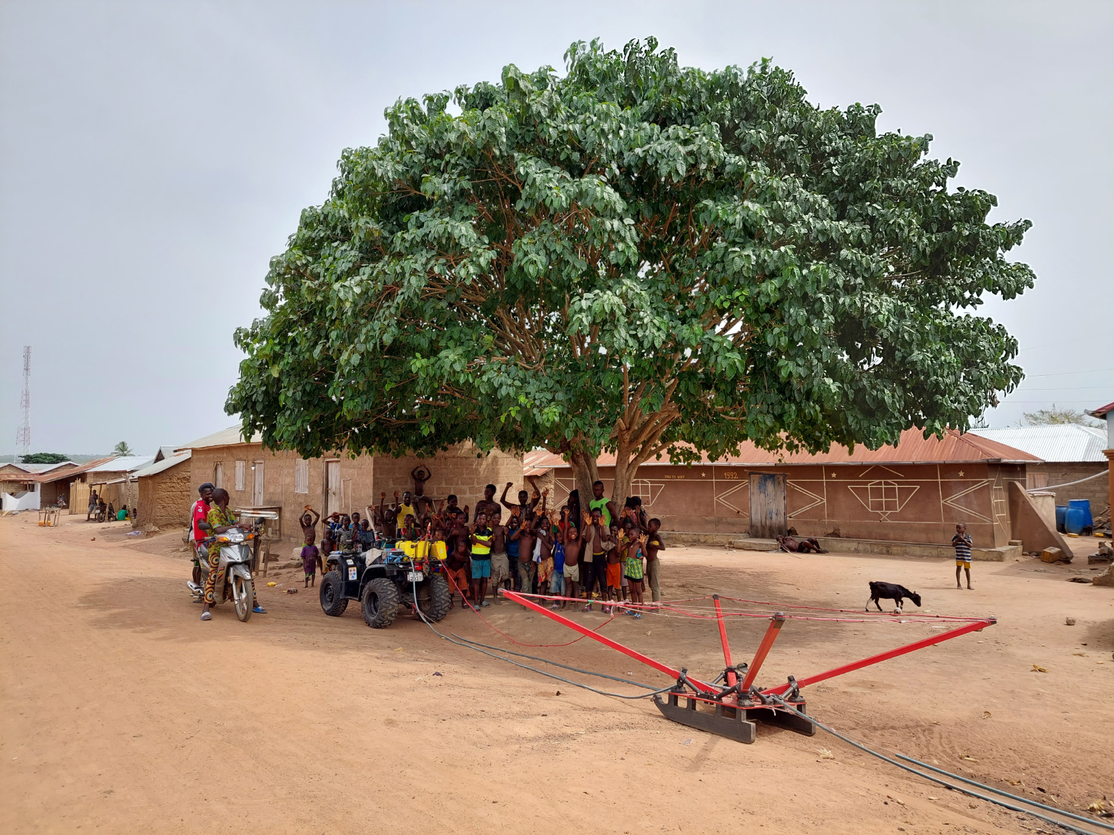
The tTEM instrument is a time-domain electromagnetic system designed for hydrogeophysical and environmental investigations. The tTEM system measures continuously while towed on the ground surface. It is designed for a very high near-surface resolution with very early time gates and a fast repetition frequency.
Results
tTEM results from the area to the east of Kpetchihoe show a thick (for the region) weathered zone consisting of more conductive material, interpreted to be clay-rich saprolite, lying on top of a poorly weathered bedrock material. At the base of this weathering profile is likely the un-weathered gneissic bedrock. The poorly weathered material atop this bedrock interface may house an unconfined aquifer system. Also, the locally thicker weathering zone suggests an increased flux of groundwater compared to neighboring areas. At some sites there is a relatively conductive layer at depth, interpreted as a fractured, water-bearing bedrock. Consequently, deep conductive layers are attractive targets as compared to dry resistive gneiss which has a resistivity of several thousands of ohmm.
Based on the tTEM resistivity models, two sites northeast of the village center were chosen, which both targeted areas where a conductive unit was seen going through the otherwise resistive bedrock. This indicated a thicker weathering zone, with the possibility of a relatively thick shallow unconfined aquifer, but also the possibility of a deeper aquifer fed through fractures in the bedrock.
During heavy rain events, which often is the case in Togo, the rain run-off quick due to the impermeable shallow un-weathered gneiss, and ultimately the water ends up in local lows in the terrain. The community of Kpetchihoe itself lies on a local ridge.
Sites A and B lie towards the lower elevations near the town, close to the river, suggesting that water recharging aquifers present at site A and B may have large catchment areas. Ultimately site B was chosen to do surface logistics.
Benefits of the survey
The tTEM system was used for spatial screening of the area surrounding the village of Kpetchihoe. The sites chosen for drilling was based on the topographic information of the catchment area, and the tTEM resistivity models. The final well-site was pinpointed to a vertical fracture, less than 100 m wide, which would have been impossible to locate without the tTEM data.
Based on the tTEM resistivity models, two sites northeast of the village center were chosen, which both targeted areas where a conductive unit was seen going through the otherwise resistive bedrock. This indicated a thicker weathering zone, with the possibility of a relatively thick shallow unconfined aquifer, but also the possibility of a deeper aquifer fed through fractures in the bedrock.
During heavy rain events, which often is the case in Togo, the rain run-off quick due to the impermeable shallow un-weathered gneiss, and ultimately the water ends up in local lows in the terrain. The community of Kpetchihoe itself lies on a local ridge.
Sites A and B lie towards the lower elevations near the town, close to the river, suggesting that water recharging aquifers present at site A and B may have large catchment areas. Ultimately site B was chosen to do surface logistics.